A telemetric system is implemented in the satellite LitSat-1 with the purpose of gathering information from the satellite sensors and transmitting it to a station on the Earth. The telemetric data is stored in the main control plate and sent to a station on the Earth through a communication transceiver. In addition to the telemetric data, the information package will include the call sign of the satellite LitSat-1 and the three words suggested by the Lithuanian people.
Last received energy data:
|
Solar panels current |
System used current |
Battery charge | |
Photo sensor data:
The data from the photo sensors is presented in the graph below. The graph consist of six curves, where each of them corresponds to on of the six sensors mounted on six satellite’s planes. The graph presents uneven illumination of the panels, which tells us two things: (1) satellite spins around the earth – planes are not always illuminated by sunlight/the satellite’s sensors are working; (2) satellite is rotating around it’s center of mass. 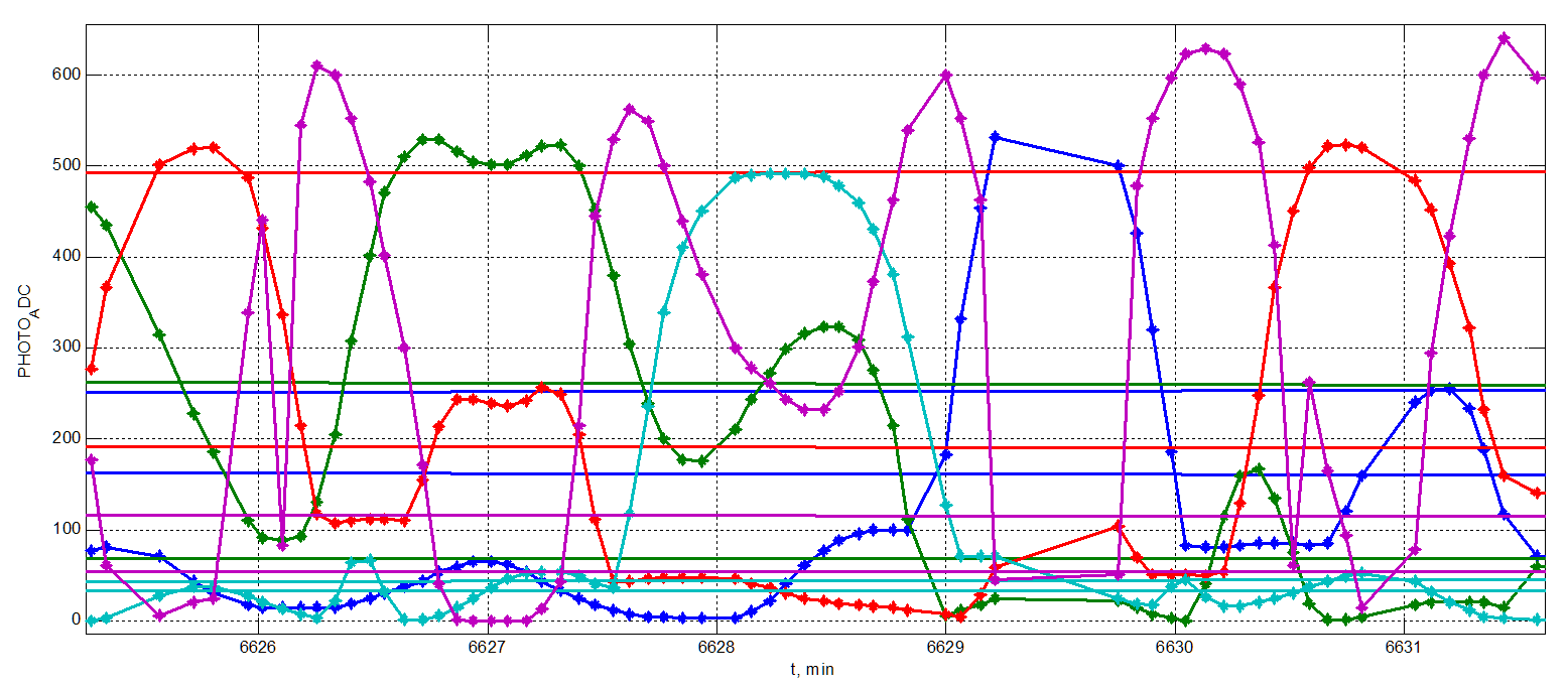
The rotation of the satellite can be caused by two main reasons: (1) the satellites were deployed from one rack at once, which lead to the fact that each satellite pushed each other with uneven stiffness separation springs/caused initial spin; (2) spin is also caused by the antenna deployment (initially antenna are wrapped around the satellite to be as compact as possible).
The moment of antenna unwrap was captured by magnetometers, photo sensors and gyros. The corresponding data is presented below, where signals jumps – reflects the satellite’s attitude during antenna unwrapping.


Latest GPS module data:


